.png)
Among ESEN's core competencies are Special Mission Aircraft Conversions, Avionics Software and Hardware Development, Aircraft Design and Certification Consultancy, Wide Area Surveillance Systems, Electronic Warfare and Intelligence Systems. ESEN aims to be a globally recognized engineering company offering pioneering technological products and solutions. The foundation of its success lies in its commitment to people, transparency, and teamwork.

AEROSTAT WIDE AREA SURVEILLANCE SYSTEM ESEN AWAS provides persistent surveillance over city-sized areas. It can detect and track up to 2,000 individuals and vehicles in real time. High-resolution watch boxes allow focused monitoring and automatic target tracking. The system offers access to both real-time and archived imagery, along with advanced search, pattern of life analysis, and anomaly detection. By fusing external data sources, it enhances situational awareness and supports effective decision-making.
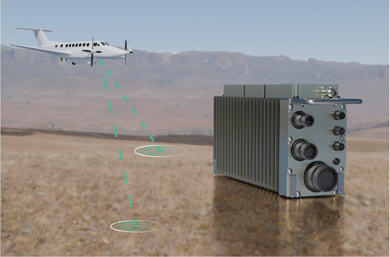
The Airborne Communication Intelligence (COMINT) System detects, demodulates, decodes, and locates Signals-of-Interest (SOI) conventional and digital Radio Frequency communication emitters with advanced Direction Finding (DF) and Signal Processing Algorithms in congested operational spectrum environments. It has the capacity for wideband detection and geolocation of weak emitter signals in the presence of strong interference. Target emitter locations are displayed on an interactive digital map with different layers. Dynamic configuration and tasking of the system allows continuous targeting of the potential emitters in the operational area.

. Designing changes and repairs on aircraft and rotocraft, minor to major changes (STCs) . Managing Certification Process . Major Engineering Project Support Services . Design Organisation Infrastructure Establishment . Airworthiness Certification Authority Infrastructure Establishment (FAA, EASA, or Military Based)
FCC SW has state of the art sensor fusion and vehicle management algorithms with various levels of autonomy, redundancies and jam-resistance navigation techniques improving flight safety and mission capability.

GoKHUN fixed-wing vertical take-off and landing (VTOL) UAV system, has optimum payload - endurance capacity in its class. GoKHUN is designed to perform intelligence, reconnaissance, and surveillance missions can stay in the air at medium altitudes for a long time, and has ease of maintenance & operation and mobile operation capability. GoKHUN UAV is the ideal unmanned aerial vehicle solution that can operate without the need for a runway thanks to its vertical take-off/landing feature and can be used on both land and sea platforms.
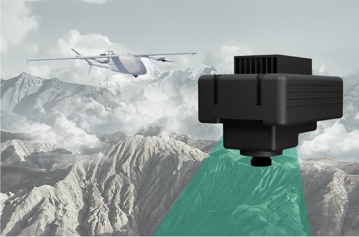
GöRDES is a state-of-the-art navigation solution designed to enable aerial platforms to navigate safely and accurately in the most challenging GNSS-denied environments. GöRDES uses advanced onboard vision technology with real-time image matching and advanced visual odometry to navigate without GNSS signals. GöRDES continuously delivers high-precision position, velocity, and attitude information, ensuring platform stability even under hostile conditions such as GNSS jamming and spoofing.
High Frequency Direction Finding And Monitoring System HF DF is the tactical and strategic High Frequency (HF) Direction Finding (DF) and Monitoring System. It provides Electronic Support Measures (ESM) for communication systems in HF band. HF DF in an ideal solution for the “tactical combat units” and “strategic commands” to obtain Electronic Order of Battle (EoB) and situational awareness. The system can be operated manned or unmanned, remotely via ethernet interface with full functionality. System provides DF and signal monitoring against targets communicating over both ground-wave and sky-wave in HF band.

LAND BASED WIDE AREA SURVEILLANCE SYSTEM Multiple high resolution camera sensors, advanced image processing capabilities, and a robust communication infrastructure, LBWASS empowers operators to detect, track, and analyze dynamic ground activity across wide areas, both day and night. Utilizing Wide Area Motion Imagery (WAMI) technology, the system detects and tracks moving targets, calculates the precise coordinates of all detected targets, and presents real time visual data within a 3D Geographic Information System (GIS).LBWASS automatically generates alerts based on predefined alarm zones, records events, and stores captured data for up to one month. These records can be queried, fetched and replayed.
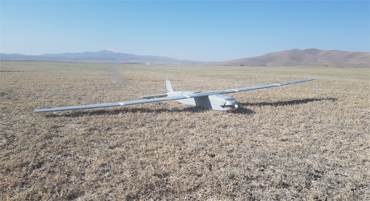
. Runway independent operations via catapult or vehicle launch and belly landing recovery . Operation continuity under GNSS denied environment via GöRDES Vision-Based Navigation system . Mobile operations (carried by 2 personnel, no need for infrastructure) . Ready for operations in 10 minutes . Low radar, visual, acoustic, and thermal traceability . Day/Night (EO/IR) operations wiht integrated camera

TRAFFIC AND TERRAIN COLLISION AVIODANCE SYSTEM NEOCAS-Traffic and Terrain Collision Avoidance System combines TCAS with Terrain Awareness Warning System (TAWS) and ADS-B In functionality to form an integrated system in a single Line Replaceable Unit (LRU). NEOCAS software is configurable so that TCAS I/TCAS II functions, TAWS Class A/Class B functions and ADS-B In function can be enabled/disabled independently. NEOCAS Processor Unit is packed in a rugged sealed chassis, hence it is suitable for the most demanding environmental conditions for both civil and military aircraft installations.

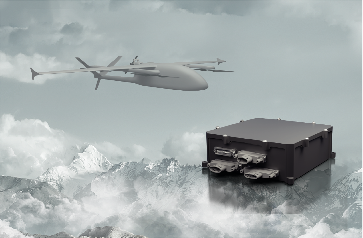
Intelligent and Realiable Power Management Unit (PMU) for Mission-Critical Systems Specifically engineered for unmanned aerial vehicles and similar platforms, our Power Management Unit (PMU) delivers up to 1.5 kW of total power capacity through an architecture based on independent power paths. With multiple input and output options, it maximizes both reliability and performance.
RADIO NAVIGATION EQUIPMENT The Radio Navigation System is a high performance, precision navigation solution specifically developed for integration into civillian and military aircraft, ensuring accurate positioning and reliable guidance in all operational environments.
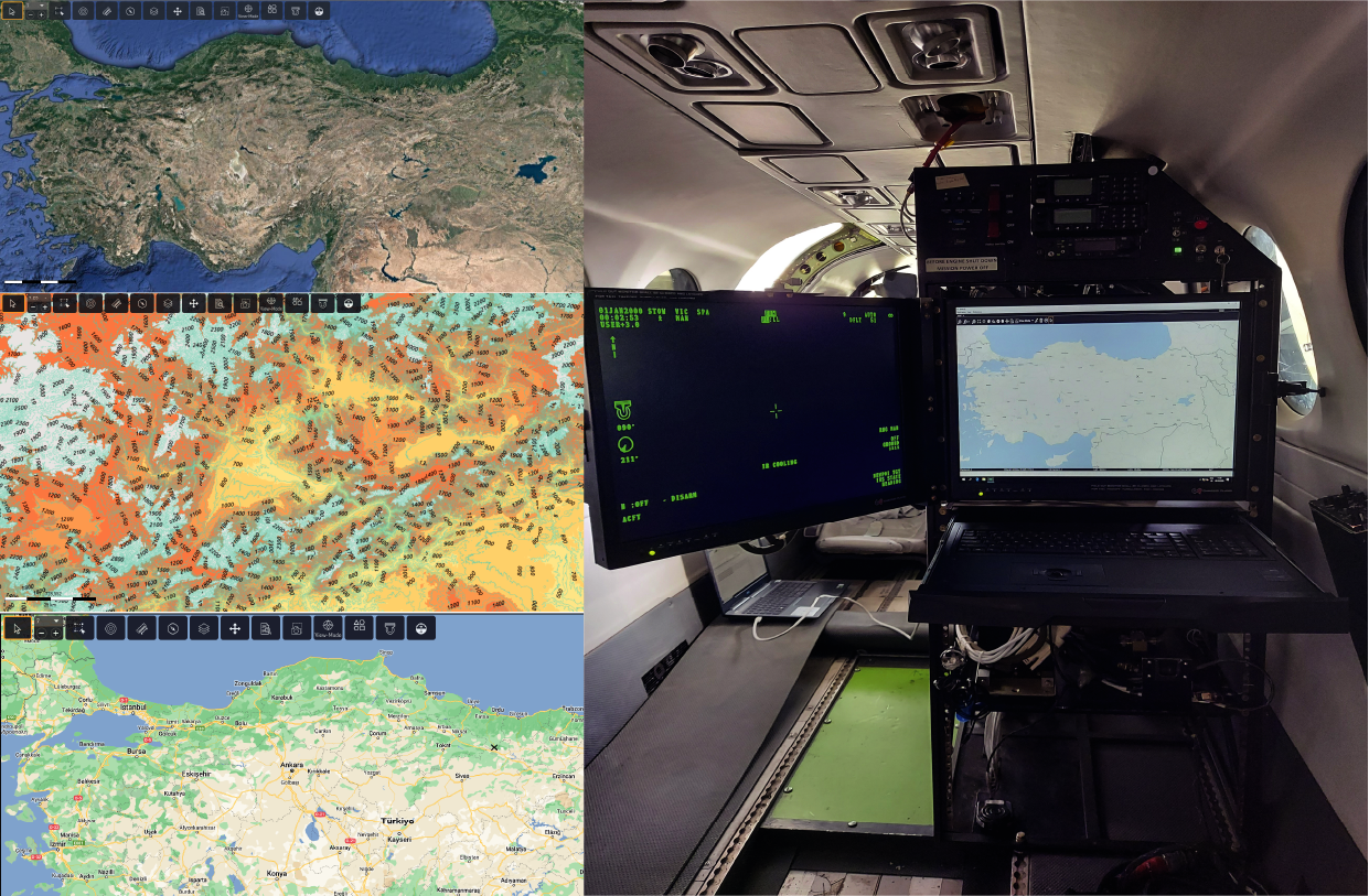
ISR MISSION MANAGEMENT AND DATA FUSION SYSTEM Wise 23 is an advanced Moving Map, Situational Awareness, and Mission Management system, engineered for high reliability and modularity. It offers seamless integration with diverse avionics architectures, sensor suites, and communication networks, ensuring optimal interoperability and mission effectiveness.

TRAFFIC AND TERRAIN COLLISION AVIODANCE SYSTEM ECAS-Traffic and Terrain Collision Avoidance System combines TCAS II version 71. with Terrain Awareness Warning System (TAWS) Class A functionality to form an integrated system in a single Line Replaceable Unit (LRU). ECAS is developed for both fixed and rotary wing aircraft platforms. ECAS Processor Unit is packed in a rugged sealed chassis with 5 MCU size compliant to ARINC 600 standard, hence it is suitable for the most demanding environmental conditions for both civil and military aircraft installations.

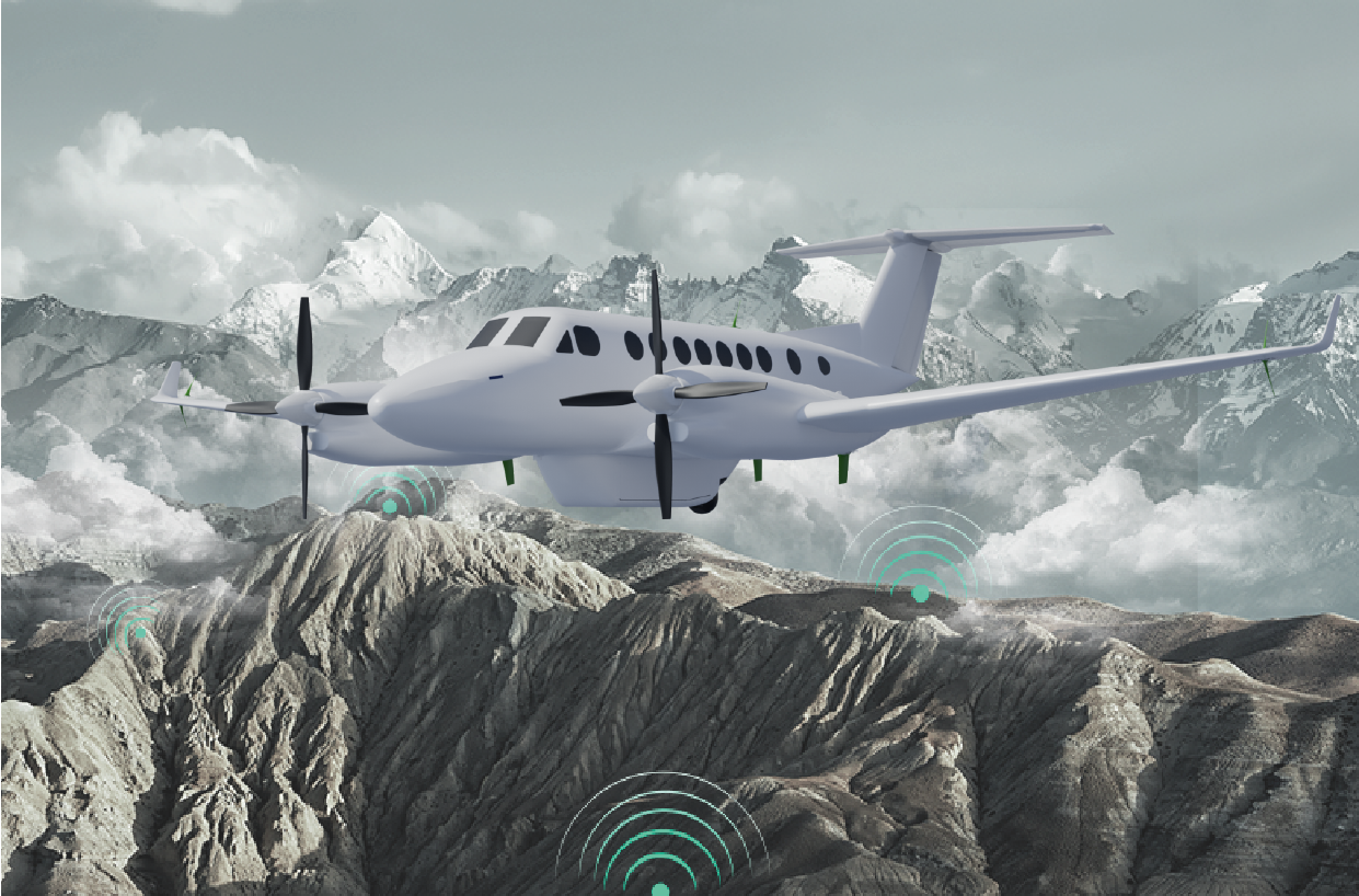
AIRBORNE WIDE AREA SURVEILLANCE SYSTEM Esen Wide Area Surveillance System (AWAS) provides continuous real time surveillance from an aerial platform. Compared to traditional aerial surveillance systems, it can display up to 100 times of the area at a comparable resolution.
Mobile Applications